Firmatek Cloud
Firmatek's platform enables users to survey stockpiles, both indoors and outdoors, using orthophotos and Lidar scan data. By leveraging these technologies, the platform provides accurate measurements, generates 3D models, and calculates volumes efficiently and safely.
The Problem
Firmatek faced challenges scaling their business because service delivery relied on manual time-consuming processes.
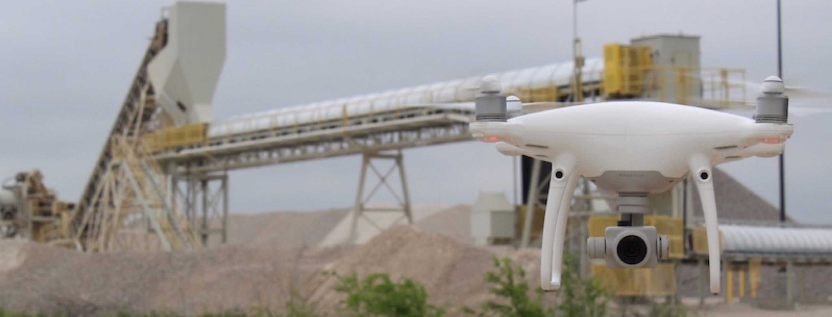
- A massive number of high resolution images needed to be copied from the drone's hard drive to their local machine.
- All of those images had to be manually imoprted into a computer program and stitched together.
- After analyzing the data, final deliverables had to be uploaded to the client handoff drive.
- If any corrections needed to be made, communication with clients happened via email where conversations could be lost.

The Solution
By optimizing this workflow with the DJI SDK and Pix4D Cloud API we were able to improve the system effinciency by 400%.
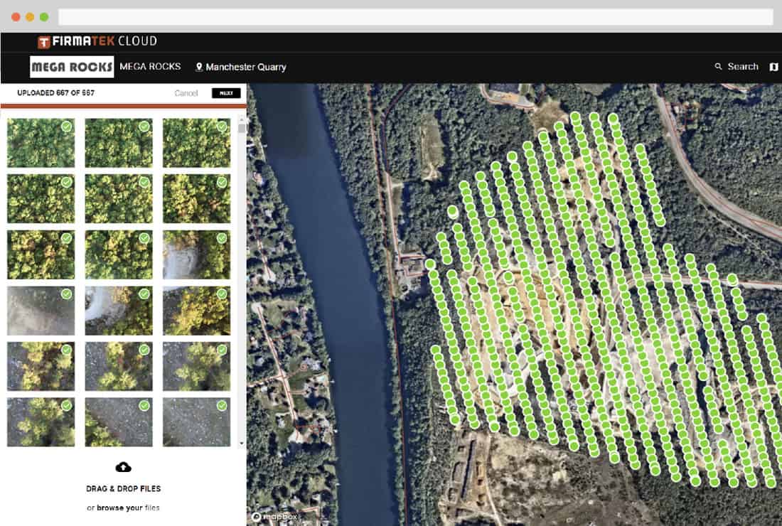
- Once a flight is completed, photos are directly uploaded from the drone to Pix4D cloud.
- Pix4D automatically performs the stitching to produce an orthophoto, which is displayed in the portal.
- Analysts then tag the photos in the portal and perform the necessary analysis.
- Once the processing is done, clients can access files directly in the portal and comment on projects to request corrections or further analysis.

Key Features
The platform includes several key features to support users in their stockpile assessment tasks. Some of the notable features I designed and implemented include:
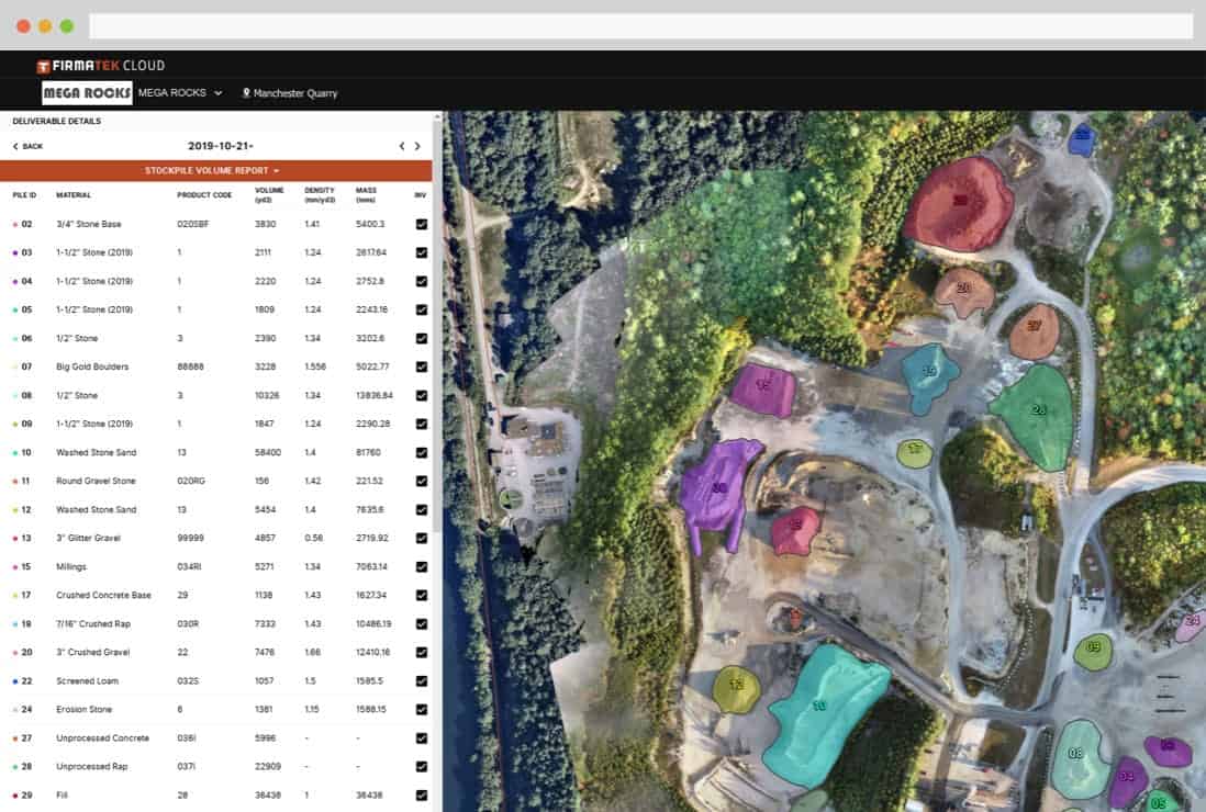
- Orthophoto Viewer: A specialized viewer that allowed users to explore high-resolution orthophotos of the surveyed areas. Users could zoom, pan, and measure distances accurately, thanks to the orthophotos' uniform scale and correction for lens distortion and topographic relief.
- Lidar Data Integration: The platform seamlessly integrated Lidar scan data, enabling users to generate precise 3D models of the stockpiles. The models provided an accurate representation of the terrain, allowing users to assess volumes and conduct detailed analysis efficiently.
- Reporting and Analytics: I designed a reporting module that facilitated the generation of comprehensive reports, including volume calculations, measurements, and other relevant metrics. These reports were essential for meeting reporting requirements and contractor deadlines, enabling users to make informed decisions based on accurate data.
Impact and Outcome
The orthophoto and Lidar scan data reporting platform significantly streamlined the stockpile assessment process for users. It offered an intuitive and efficient interface for visualizing, measuring, and analyzing stockpiles, enhancing accuracy and saving valuable time. The integration of orthophotos and Lidar scans provided users with a comprehensive view of the terrain, empowering them to make informed decisions regarding stockpile management.
Throughout the project, I collaborated closely with the development team to ensure the seamless integration of design and technology. By incorporating user feedback and continuously iterating on the design, we created a robust and user-friendly platform that met the needs of surveyors, contractors, and other stakeholders.