Measure: Ground Control
Ground Control provides a complete solution for managing drone programs, including team and fleet management, flight planning, data validation, processing and analytics.
Design Process
To create a user friendly software solution, I followed a human-centered design process that prioritized the needs and workflows of the UAV Piolots and organizations managing drone operations. I conducted extensive user research, going out in the field to experience firsthand the nuanced requirements and challenges inherent to operating within public airspace.

Key Features:
Measure Ground Control encompassed a wide range of features to support users in their drone deployment and data management tasks. Some of the key features I designed and implemented include:
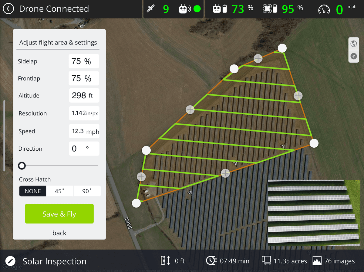
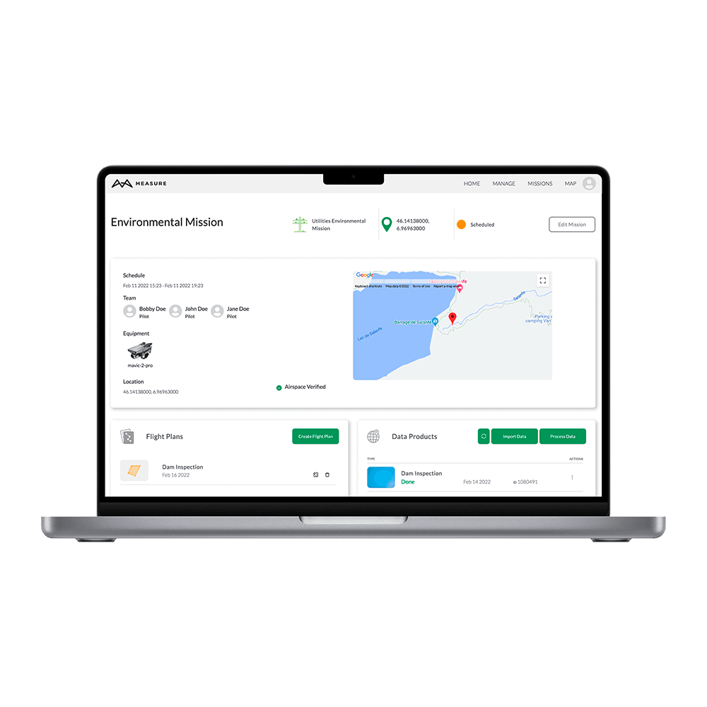
- Mission Planning and Flight Management: Users could create missions, plan flights, and check airspace within the software. The platform provided a variety of flight modes, such as Panorama, Spotlight, POI, Profile, Trace, and Tripod, catering to different operational needs. Users could also manage pilots and drone fleets, create and reuse flight plans, store fly sites, and maintain flight schedules.
- Image Data Processing: The software offered advanced photogrammetry and image processing capabilities, including high-quality orthomosaics, 3D maps, 3D mesh, thermal imagery, digital surface models (DSM), and more. Integration with the Pix4D toolkit allowed users to process and create accurate data products, while a custom Scopito integration enabled image inspection and annotation.
- Data Reporting and Customization: Measure Ground Control provided users with the ability to generate customized data reports, facilitating effective data analysis and communication. Users could tailor the reports to their specific requirements, ensuring they had the necessary insights to make informed decisions.

Impact and Outcome
Through seamless integration between web and mobile applications, users could access the software across devices and maintain their operational efficiency on the go. The intuitive user interface and streamlined workflows minimized the learning curve and enhanced productivity for users at all levels of expertise.
Working on Measure Ground Control allowed me to leverage my UX design skills to create a platform that addressed the unique challenges of the UAV industry. The project reinforced the importance of user research, iterative design, and collaboration in developing software solutions that meet.